New South Wales (NSW) is facing a heightened risk of flooding and severe weather as heavy rain and storms continue to impact multiple regions across the state.
Severe Weather Warning Across NSW
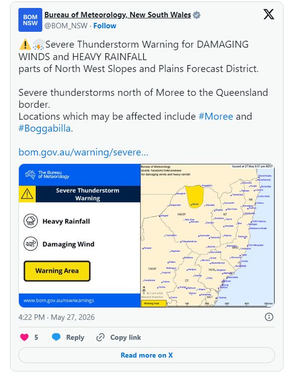
The Bureau of Meteorology has issued a severe weather warning, particularly for the Hunter and Mid North Coast regions. In the coming hours, residents may experience:
- Prolonged heavy rainfall
- Severe thunderstorms with damaging winds
- Large hail
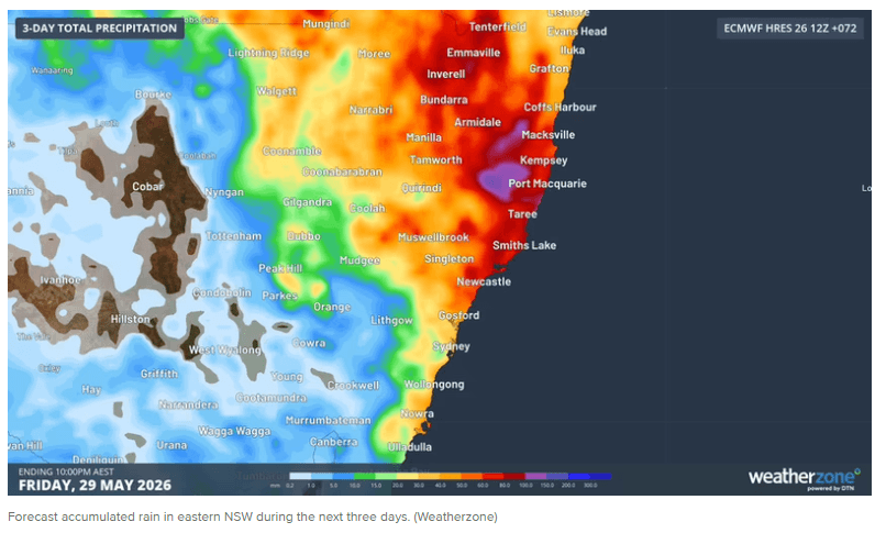
Rainfall totals are expected to range between 20mm and 40mm, with slow-moving storms potentially bringing intense downpours of up to 70–80mm in some areas.
Increasing Risk of Flash Flooding
A strong low-pressure system developing from southern Queensland and northern NSW is the main driver of this widespread rainfall event.
In areas such as Barrington Tops, rainfall could peak at around 95mm, significantly increasing the risk of:
- Sudden flash flooding
- Localised inundation in low-lying areas
Rivers including the Paterson, Williams, Manning, Gloucester, Goulburn, and Hunter are likely to experience minor flooding from tonight into tomorrow.
Authorities Urge Residents to Stay Alert
The NSW State Emergency Service (SES) warns that flash flooding can occur rapidly with little warning.
Residents are advised to:
- Avoid driving through flooded roads
- Do not enter floodwaters
- Stay updated with the latest weather alerts
- Prepare emergency response plans
Weather Outlook
Conditions are expected to ease by the weekend as the weather system moves offshore. However, in the short term, the risk of storms and flooding remains high.
Outside NSW, parts of Tasmania are also under flood warnings, particularly along the South Esk River.
Source: 9News